
Today is the day before Milton’s winds begin to hit. The wind and rain will arrive tomorrow (Wednesday). The center of the storm is projected to be nearest us at about 4 AM Thursday morning.
I’ve taken a few screenshots to capture what it looks like right now.
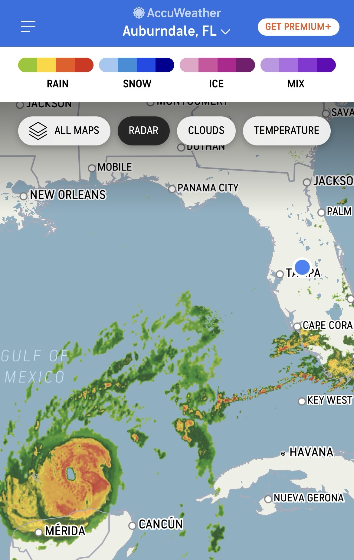
First, the storm. Here is a radar picture of Milton as it churns in the Gulf.
The next screenshot is the trajectory. We anticipate having it go over (or near) the top of us around 4 AM on Thursday. Hurricane Milton is anticipated to be a Cat 3 when it hits near the Tampa Bay area and should be downgraded to a Cat 2 or 1 when it gets to us. The damage to the Tampa Bay area could be like none they’ve ever experienced before, depending upon the precise location that the hurricane makes landfall.

Some might say, “Why don’t you evacuate?” Well, Floridians understand that such a question requires a lot of variables. First, newer houses are built to withstand Category 3 or 4 hurricanes. Houses are block/concrete with roofs that are braced to the concrete walls. So, they are basically a mini-fortress. The only real points of exposure are loose shingles/siding (that can cause leaks) or windows and sliding doors (that can leak or break).
Further, the roads are filled. There are hundreds of thousands of people who are in an evacuation zone. So, they are currently being told to get to safety immediately. That causes most gas stations to run out of gas (currently the case). It also put hundreds of thousands of people on the roads, and there are only two major thoroughfares that run north and south (I-75 and I-95).
In the following picture, you can see that I-75 North is busy. The roads to the left of the picture are the entrance ramps from the Florida Turnpike that bring traffic from Orlando. Orlando is where people are evacuating TO. That’s why the Turnpike is not filled. Also notice the vehicles driving on the shoulders. That is permitted by the governor during times of evacuation. Sometimes, the southbound lanes of the major interstates are reversed so that both sides of I-75 and I-95 are northbound.

Finally, we are blessed that we’ve got some Fall Florida weather for the next few days. If we lose power, and that will almost certainly be the case, we can open the windows. Typically, the weather doesn’t cooperate like this. Generally, hurricanes cause major power outages when it is very hot and humid.

So, this is my Tuesday morning update as I recount what is probably going to be a historic hurricane. We are praying for the best but preparing for the worst.
Oh, and one more thing. Jim Cantore with the Weather Channel is bad luck. He seems to enjoy taking his position at the most dangerous places as hurricanes approach land. So, where is he now? Next to Tampa General Hospital, 49 miles from here.


Thank you for the update! I’m reminded when there was a raging storm and Pete was in the boat. Jesus told the winds to be still and they did. The same God that told the storm to obey is the same God we serve! Praying for the Floridians.
LikeLiked by 1 person
Bingo! And thank you!
LikeLike